Registration with Survey Targets

Registration with Survey Targets
|
Registration to a survey control points using survey targets is achieved by one of two methods: scan-to-scan or scanproject-to-control.
|
|||||||||||||||||


"scan-to-scan" registrationIn the scan-to-scan method, a collection of unregistered LIDAR scans, with visible survey targets, are located onto an imported survey control network achieving scan-to-scan registration with survey control over a large area. Start by placing markers on visible targets in each scan. Use the ScanData Cycler button Once enough targets on each each scan are marked, select some or all of the scans and compute the registration. If some scans fail to register, use "Ctrl+Z" to undo the registration transform. Confirm the position of the targets or mark additional targets that overlap the adjacent scans and recompute the registration. |
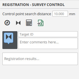
Register a survey control network |
"scanproject-to-control" registrationA scan project containing multiple LIDAR range images previously registered, or any unified point cloud model, can be located to a survey control network by marking three or more corresponding targets within the scan data model. With a typical registered LIDAR project, begin by selecting all scans and lock the transform, then group the scan under one node. Registration of the group is as a single scan or unified model. select this group node when calculating the registration. After transform to the control point the cloud-to-cloud registration will be maintained. Place corresponding markers on visible targets in a selected scan using the ScanData Cycler button |
|


Object selection for workflows
Scans with survey targets and survey control network
Select the unlocked scans and make the survey control network visible.
Scans with Spherical targets
Select the scans with spherical targets. If all the scans are unlocked, then first scan is considered locked and others are registered to it.
Scans with Mix of Spherical targets and Survey targets
The survey targets and spherical targets can be freely mixed together to compute registration.
Registered Scans with another set of Registered Scans
Register, a set of scans registered together (Set1) with another set of registered scans (Set2). Follow this workflow:
- Group scans of set1 together (Group1), and also group scans of set2 together (Group2).
- Lock Group1 and keep Group2 unlocked. As a check verify that both Group1 and Group2 now contain scans inside that are registered to each other within the set and locked.
- Select both Group1 and Group2, and calculate.
Note that either of set1 or set2 could have been registered with spherical targets, survey targets or mix of both. Also when Group1 is locked, there can be other groups such Group3, Group4 etc that can be registered together.
Registered Scans with Survey Control Network
Group each set of registered scans into its own group node in objectlister. Keep each group unlocked, select the unlocked group node and calculate registration.
Advanced topics
- Often the scandata from sensor mounted on a drone or non-terrestrial scanners is noisy, or has considerable distortion. In such cases, you may need to increase the matching tolerance. The current maximum tolerance is 0.010m (10mm). Say if you need to increase it to 0.2m for drone data, you can type this command in the command prompt in the bottom left corner of main window (ensure there are no extra spaces):
SystemVar --key "Registration/Stitching_Tol" --value 0.200 --type_float
Created with the Personal Edition of HelpNDoc: Maximize Your Documentation Output with HelpNDoc's Advanced Project Analyzer